PA Wilds Center has partnered with Purple Lizard to scout out future maps of PA Wilds
PA Wilds Center has partnered with Purple Lizard to scout out future maps of PA Wilds
The PA Wilds Center for Entrepreneurship, Inc. (PA Wilds Center) has partnered with Purple Lizard Maps to develop a high-level plan to bring Purple Lizard Maps of the PA Wilds region to market.
The Pennsylvania Wilds region is home to more than 2 million acres of public lands, including endless opportunities for outdoor recreation, 16,000 miles of streams and rivers, the largest wild elk herd in the northeastern U.S., the world’s second-certified International Dark Sky park, two National Wild & Scenic Rivers, PA’s only National Forest, and more. With all there is to explore in this expansive rural landscape, creating and producing accurate maps can be a challenge, one that Purple Lizard Maps is well versed in.
“The PA Wilds region is a prime outdoor recreation destination spanning 13 counties that contains many unique terrains which often don’t include cell phone service. Therefore, it’s critical that physical maps be both detailed and as accurate as possible,” says Hannah Brock, Licensing Manager for the PA Wilds Center.
Enter Purple Lizard Maps! Based in State College, just outside the PA Wilds footprint, they have been creating recreational trail maps of Pennsylvania State Forests since 1997. Known for exceptional cartographic design that unlocks broad landscapes for exploration, Purple Lizard has a strong following among destination travelers in the Mid-Atlantic Region. Their maps are printed on durable, waterproof paper designed for real adventures while hiking, bicycling, boating, camping and exploring the back roads and small towns. Purple Lizard maps are sold throughout the Mid-Atlantic Region at small businesses and large retailers like REI. Currently, Purple Lizard has 18 maps in its product line, including 12 titles in Pennsylvania.
Purple Lizard believes in examining the big picture when it comes to mapmaking. They spend time immersed in the areas they map, meeting with land managers, community leaders and shop owners which all help to inform the design process to make the best maps available for both visitors and residents.
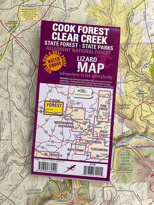
Purple Lizard Maps currently sells some maps of places within the PA Wilds region, such as the Cook Forest and Clear Creek area, Moshannon State Forest and Quehanna Wild Area, and the Pine Creek and PA Grand Canyon area. The new partnership with the PA Wilds Center will help scout out potential future maps in the PA Wilds region.
“Our intensive process blends all the best elements of old-world mapmaking artistry, on-the-ground research, and attention to detail, with the benefits of leading-edge digital cartographic design,” states founder and lead cartographer Michael Hermann. “Our maps are highly curated for recreation, and this allows us to create the most detailed and beautifully designed map ever produced of that area – and one that can lead the user on endless adventures.”
PA Wilds Center CEO Ta Enos says having up-to-date, accurate, high quality maps of the PA Wilds region is key to helping visitors have a positive and safe outdoor experience, making the outdoors and our region’s vast public lands more accessible, and encouraging visitors to continue exploring rural communities and small businesses on their adventures. “A handful of Purple Lizard Maps already touch on assets in the PA Wilds, and we know some of our communities have expressed interest in developing others,” Enos said. “While Purple Lizard maps are popular, they can be cost prohibitive for highly rural areas to develop and bring to market without a coordinated multi-partner approach. Our hope is this project will begin to lay that groundwork.”
The assessment and stakeholder engagement by Purple Lizard Maps will set the stage for potential maps of the PA Wilds region in the future. The goal is to compile a list of potential map projects that can be executed in phases once funding is secured.
The assessment and planning stage of the PA Wilds map project is supported through funding from the PA Department of Conservation and Natural Resources (DCNR) and the Richard King Mellon Foundation. “This project brings a lot of opportunity to rural communities that are trying to use outdoor recreation to help them diversify and revitalize,” Enos said. “We greatly appreciate their investment.”
If you or your organization would like to contact Purple Lizard with information on trails in the PA Wilds region, call 814-876-2363.
ABOUT THE PA WILDS
The Pennsylvania Wilds is a 13-county region that includes the counties of Cameron, Clarion, Clearfield, Clinton, Elk, Forest, Jefferson, Lycoming, McKean, Potter, Tioga, Warren, and northern Centre. The PA Wilds Center for Entrepreneurship, Inc., is a 501(c)3 nonprofit organization whose mission is to integrate conservation and economic development in a way that inspires the communities of the Pennsylvania Wilds. The PA Wilds Center promotes the region and its 2+ million acres of public lands as a premier outdoor recreation destination as a way to diversify local economies, inspire stewardship, attract investment, retain population and improve quality of life. The PA Wilds Center’s core programs seek to help businesses leverage the PA Wilds brand and connect with new market opportunities, including: the Wilds Cooperative of PA, a network of more than 575 place-based businesses and organizations, and the PA Wilds Conservation Shop, a retail outlet primarily featuring products sourced from the WCO. For more information on the PA Wilds Center, visit www.PAWildsCenter.org. To learn more about the WCO, visit www.WildsCoPA.org. Explore the PA Wilds at www.PAWilds.com. Find regionally made products at www.ShopThePAWilds.com.
ABOUT PURPLE LIZARD MAPS
Purple Lizard Maps was founded in 1997 by award-winning cartographer Michael Hermann, with a mission to become a leader in recreational map design. Purple Lizard Maps are defined by their award winning industry leading quality. They include all the fancy topographic and hydrographic info to help you plan successful adventures, but are also exceptionally easy to read and understand. Purple Lizard Maps are built for adventure, printed on durable waterproof paper and designed to last.
Media Contact
Britt Madera | Communications Manager
PA Wilds Center for Entrepreneurship, Inc.
[email protected] | 570-948-1051