PA Wilds Outdoor Discovery Atlas showcases rural region’s unique assets, navigable maps
PA Wilds Outdoor Discovery Atlas showcases rural region’s unique assets, navigable maps
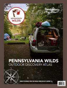 A new tool is now available to people looking for unique places to visit in the rural Pennsylvania Wilds, a designated 13-county region in north central and northwest Pennsylvania. The PA Wilds Outdoor Discovery Atlas features over 45 pages of travel inspiration and useful details for navigating to some of the region’s most popular destinations as well as other points of interest.
“This is the first PA Wilds-branded print map of the region since 2010,” said Ta Enos, CEO of the PA Wilds Center for Entrepreneurship (PA Wilds Center), the nonprofit that produced the Atlas. “So much has changed on the ground since then, with new state-of-the-art visitor centers, trail connections and other outdoor rec asset improvements in so many communities. When the PA Wilds core marketing infrastructure integrated into our nonprofit in 2016-17, the map project was at the top of our list to overhaul and get back into print.”
In late 2018, thanks to partial funding from the PA Department of Conservation and Natural Resources (DCNR) and the PA Wilds Marketing Corporation, PA Wilds Center began to develop a new map of the PA Wilds. Hundreds of thousands of people travel to the PA Wilds every year, fueling a growing $1.8B tourism industry. The region is known for being home to the largest concentration of public lands in the Commonwealth — over 2 million acres, as well as the largest wild elk herd in the northeast, world-famous night skies, the Allegheny National Forest and thousands of miles of land and water trails.
“Our visitor bureau partners and DCNR developed the first map, and it was such a popular resource,” Enos says. “Parts of the PA Wilds are rugged and wild, and cell reception can be spotty, so having a navigable print map to accompany pawilds.com is important. Our goal was to build on that base, weave in more of the story of our region’s conservation legacy and entrepreneurial spirit, and create a model that was sustainable so it would not go out of print again. We thank all of our funders, partners and contractors for their help on this project. Maps are not an easy thing to tackle. Our Communications Director, LaKeshia Knarr, did yeoman’s work overseeing production of the Atlas.”
In addition to financial support, DCNR staff provided invaluable insights to help ensure accuracy of information presented in the Atlas.
“DCNR’s partnership with PA Wilds Center to collaborate and lead work in the PA Wilds Conservation Landscape has resulted in tangible and useful products like this one that assists DCNR in its mission to provide excellent visitor experiences to all who seek to explore the more than 2.2 million acres of public land in the region,” said Meredith Hill, DCNR’s PA Wilds and Conservation Landscape Program Director. “We were glad to help support the creation of this very worthwhile new resource especially at a time when visitation to our state parks and forests is at an all-time high as people seek the outdoors as a place of solace during the COVID pandemic.”
Telling the region’s story in an authentic way was important to all of the partners involved.
“We saw this project as a true opportunity to build on our region’s conservation legacy and collaborative spirit by choosing to produce the entire Atlas within the PA Wilds,” said Abbi Peters, EVP of Operations at the PA Wilds Center and co-founder of the Wilds Cooperative of PA business development network managed by the nonprofit. “We are proud to have contracted with The Graphic Hive in Williamsport for the design, Domtar to source paper from their Johnsonburg mill, local photographers to fill the Atlas with beautiful images of our awe-inspiring region, and Bayard Printing Group in Williamsport to print the final product. We know that this supported new opportunities for collaboration and jobs in our rural landscape, in addition to cutting down our environmental footprint.”
“The Graphic Hive is immensely proud of our contribution to the Pennsylvania Wilds Outdoor Discovery Atlas and also humbled to have the opportunity to work on a project with the potential for such impact, said John Yogodzinski, owner of The Graphic Hive. “Not only is it a fully immersive travel guide to our region, but by sourcing everything from within the PA Wilds, it is also a testament to the creativity, ingenuity and hard-working spirit of its residents.”
The atlas underscores the region’s rich conservation legacy by reflecting on its history as the Lumber Capital of the World during the Industrial Revolution, the impact the lumber industry has had and continues to have within the landscape, and how decades of concerted efforts brought back the beautiful forests seen today. Conservation of our forests has created economic value as well, including the region’s $1.8B tourism industry and a continued $1.2B hardwood lumber industry statewide.
“When PA Wilds Center first approached Domtar about this project and said the goal was to produce the Atlas 100% in-region and to weave in details about our region’s rich lumber and conservation legacy, we were immediately drawn to the project as it aligned with our own Sustainable Forestry Principles,” said Luke Dillinger, Wood Procurement Manager at Domtar. “The PA Wilds Outdoor Discovery Atlas has the power to not only help travelers navigate our rural region, but to help them interpret the region’s incredible lumber heritage and the beauty we see before us today. Domtar is incredibly proud to have provided paper sustainably sourced from the Pennsylvania Wilds for the Atlas.”
MORE ABOUT THE ATLAS
The PA Wilds Outdoor Discovery Atlas, a print companion to pawilds.com, orients seekers to the large region by breaking it down into thematic sub-regions, or landscapes, based on headliner experiences. The identified landscapes include: Allegheny National Forest & Surrounds, Cook Forest & the Ancients, Dark Skies, Elk Country, I-80 Frontier, and Pine Creek Valley and PA Grand Canyon. Each landscape section showcases inspirational photos and outlines some of its unique characteristics, communities, and destinations. It also includes a directory of visitor organizations serving the landscape to help travelers plan their trips. In addition to the landscapes, the Atlas highlights regional heritage areas, including Lumber Heritage Region and PA Route 6 Alliance, conservation partners, a directory of popular regional trails by activity, and more!
The PA Wilds Outdoor Discovery Atlas is now available at the PA Wilds Conservation Shop at Kinzua Bridge State Park, 296 Viaduct Road, Mt. Jewett, PA, or online at ShopThePaWilds.com, and it will also be available for sale via regional partners (it retails for $9.95+tax). Retailers and organizations in the PA Wilds that are interested in selling the PA Wilds Outdoor Discovery Atlas are invited to do so. For more information, or to access free content from the Atlas, visit pawilds.com/outdoor-discovery-atlas/. To purchase a copy of the Atlas online, click here.
ABOUT THE PA WILDS
The Pennsylvania Wilds is a 13-county region that includes the counties of Cameron, Clarion, Clearfield, Clinton, Elk, Forest, Jefferson, Lycoming, McKean, Potter, Tioga, Warren, and northern Centre. The PA Wilds Center for Entrepreneurship, Inc., is a 501(c)3 nonprofit organization whose mission is to integrate conservation and economic development in a way that inspires the communities of the Pennsylvania Wilds.
The PA Wilds Center promotes the region as a premier outdoor recreation destination as a way to diversify local economies and improve quality of life. The PA Wilds Center’s two core programs seek to help businesses leverage the PA Wilds brand and connect with new market opportunities: the Wilds Cooperative of PA, a network of over 300 place-based businesses and organizations, and the PA Wilds Conservation Shop, a retail outlet primarily featuring products sourced from the WCO. For more information on the PA Wilds Center, visit www.PAWildsCenter.org. To learn more about the WCO, visit www.WildsCoPA.org. Explore the PA Wilds at www.pawilds.com.
Media Contact
LaKeshia Knarr, PA Wilds Center Communications Director
[email protected] | 570-295-9014
Congratulations to PA Wilds, DCNR, and everyone involved in production of the PA Wilds Discovery Atlas. I believe these efforts to promote the natural and outdoor recreational features of Pennsylvania’s various regional landscapes are valuable assets to rural communities and our ecological resources. Keep up the good work, and thank you.
Ben Moyer
Thank you, Ben! We appreciate your support.